


Town Hall Voting District, Henrico County, Virginia
About
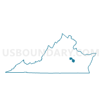
Outline

Summary
| Unique Area Identifier | 681888 |
| Name | Town Hall Voting District |
| County | Henrico County |
| State | Virginia |
| Area (square miles) | 15.84 |
| Land Area (square miles) | 13.39 |
| Water Area (square miles) | 2.45 |
| % of Land Area | 84.54 |
| % of Water Area | 15.46 |
| Latitude of the Internal Point | 37.40810600 |
| Longtitude of the Internal Point | -77.35476550 |
Maps


Graphs
Select a template below for downloading or customizing gragh for Town Hall Voting District, Henrico County, Virginia


Neighbors
Neighoring Voting District (by Name) Neighboring Voting District on the Map
- Bellwood Voting District, Chesterfield County, VA
- Dorey Voting District, Henrico County, VA
- Elizabeth Scott Voting District, Chesterfield County, VA
- Enon Voting District, Chesterfield County, VA
- Mehfoud Voting District, Henrico County, VA
- Sullivans Voting District, Henrico County, VA
- Whitlocks Voting District, Henrico County, VA
Top 10 Neighboring County Subdivision (by Population) Neighboring County Subdivision on the Map
Top 10 Neighboring Unified School District (by Population) Neighboring Unified School District on the Map
Top 10 Neighboring State Legislative District Lower Chamber (by Population) Neighboring State Legislative District Lower Chamber on the Map
- State House District 66, VA (88,542)
- State House District 70, VA (79,380)
- State House District 62, VA (76,461)
Top 10 Neighboring State Legislative District Upper Chamber (by Population) Neighboring State Legislative District Upper Chamber on the Map
Top 10 Neighboring 111th Congressional District (by Population) Neighboring 111th Congressional District on the Map
Top 10 Neighboring Census Tract (by Population) Neighboring Census Tract on the Map
- Census Tract 1004.03, Chesterfield County, VA (5,509)
- Census Tract 2016.02, Henrico County, VA (4,916)
- Census Tract 2016.01, Henrico County, VA (3,151)